Is There Gold In Them There Hills?
Our satellite and drone system will tell you (and other minerals too).
Hawkeyes uses satellite and drone imagery, LiDAR, Airborne Electromagnetic (AEM) data, and Convolutional Neural Network(CNNCNN — Convolutional Neural Network: An AI model that analyzes satellite band data to identify mineral signatures.) to map geochemistry formations and pinpoint mineral deposits in your project area, and not just gold.
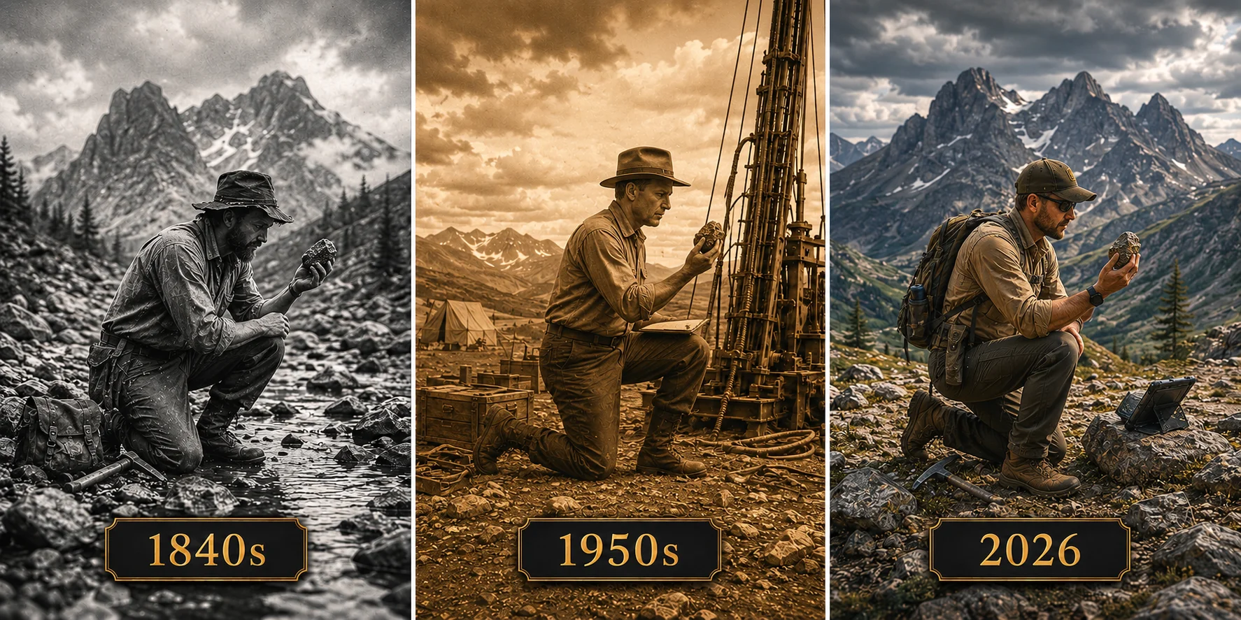
Exploration Hasn't Changed.
Most mining companies still prospect the same way: field teams, rock sampling, expensive surveys, and months of manual interpretation.
Meanwhile, satellites have already scanned the same terrain thousands of times.
Those scans contain geological signals linked to mineral deposits:
"The data exists. Interpretation is broken."
We analyze satellite data with AI and tell you where to dig, you dig?
Hawkeyes combines multiple geological data sources into a single AI-driven exploration system:
Satellite imagery
LiDAR terrain mapping
Airborne Electromagnetic (AEM) data
CNNCNN — Convolutional Neural Network: An AI model that analyzes satellite band data to identify mineral signatures. analysis
Geological structural analysis
Our AI models analyze these layers together to identify high-probability mineral targets before field crews even arrive onsite. You get:
Ranked drill targets
Confidence scoring
Geological pattern analysis
Exploration maps your team can act on immediately
We're not a mining platform.
We're your drill.
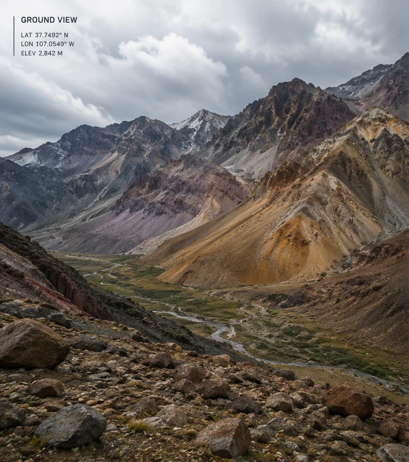
Ground View
LON 107.0549° W
ELEV 2,842 M
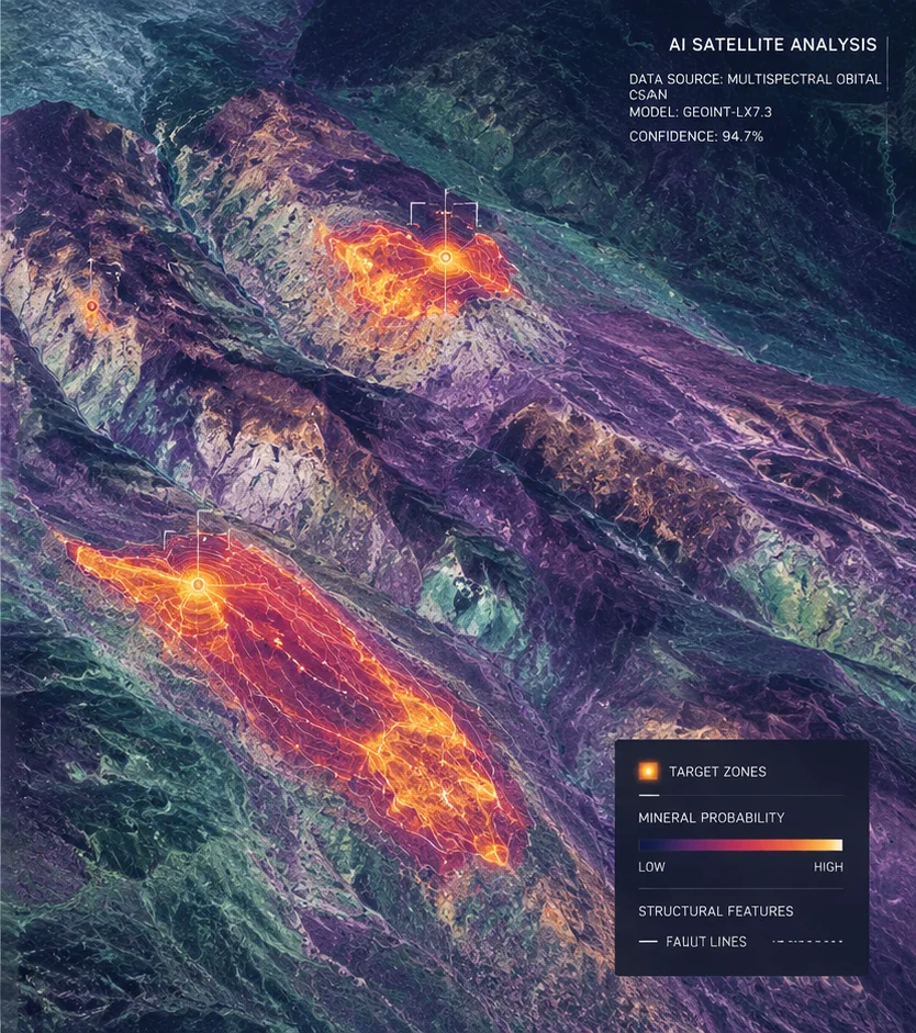
Satellite Analysis
To view a sample report, please fill out our form.
Not Just Gold.
Minerals. Other minerals. Oil. Gas. If it can be mined or extracted, it's fair game.
If it can be mined and extracted, chances are our satellites and drones can identify it.
Three Steps, Two Phases
No Massive Field Program Required.
Step 01
Tell Us Where
Send us your area of interest - coordinates, shapefiles, or a polygon boundary.
The platform coordinates data acquisition: satellite passes, terrain data, spectral layers, LiDAR, and airborne EM datasets. Typical cost, on average, $12,000 (depending on the amount of area scanned).
Step 02
We map and run the AI
Our mapping platform processes all possible geological layers looking for mineralization signals and structural correlations. This includes:
- Hydrothermal alteration detection
- Vegetation stress analysis
- Fault and structure mapping
- Spectral mineral identification
- Deep pattern recognition using CNNCNN — Convolutional Neural Network: An AI model that analyzes satellite band data to identify mineral signatures. models
Convolutional Neural Networks (CNNCNN — Convolutional Neural Network: An AI model that analyzes satellite band data to identify mineral signatures.s) are AI models trained to identify geological patterns, mineral signatures, and structural anomalies directly from satellite imagery. Read some of our papers and blogs on CNNCNN — Convolutional Neural Network: An AI model that analyzes satellite band data to identify mineral signatures..
Step 03
You Get the Report
You receive:
- Georeferenced exploration maps
- Ranked target zones
- Confidence scores
- Anomaly overlays
- Mineral probability analysis
Your geological team gets a clearer picture of where to focus excavatingc — and where not to waste the budget.
See a sample reportStep 01
Satellite Goes Deeper
We upgrade to a much sharper satellite — up to 33× more detailed than Phase 1. It covers all six target zones and picks up mineral signals that the first pass could only estimate. More data in, better targets out.
- Up to 33× sharper imagery than Phase 1
- Detects clay, iron, and alteration minerals from orbit
- Covers all six ranked zones in a single pass
Step 02
The Drone Flies In Close
A drone flies at just 30–100 m above the ground — below cloud cover, below the bog, right above the rock. It sees surface detail no satellite can match and, with the right payload, can detect what is happening just beneath the surface too.
- Sub-10 cm resolution over the top priority zones
- Flies below interference that limits satellite sensors
- Magnetic payload reveals buried structure and faults
Step 03
Both Combined = Precise Drill Targets
Satellite data and drone data are fused together in our AI. The result is not a broad zone — it is a precise intercept telling you exactly where to put the drill. Delivered in 3–4 weeks, fully yours to keep.
- Ranked drill intercepts with UTM coordinates
- Confidence scores backed by two independent data sources
- GeoTIFF maps, QGIS project, and full technical report
The pipeline is reusable — any additional property you hold can be run through the same system.
Satellite Sees What We Can't
The human eye can see three colors — Red, Green, and Blue (RGB). Our satellite can see thousands more that the human eye is not capable of. Various minerals leave various color signatures. We find them and report it to you. This saves you a lot of time from having to speculate.
From Speculation →DeterminationVerificationExploration
 Human Eye
 Hawkeyes Satellite
Exploration Intelligence Built for Mining
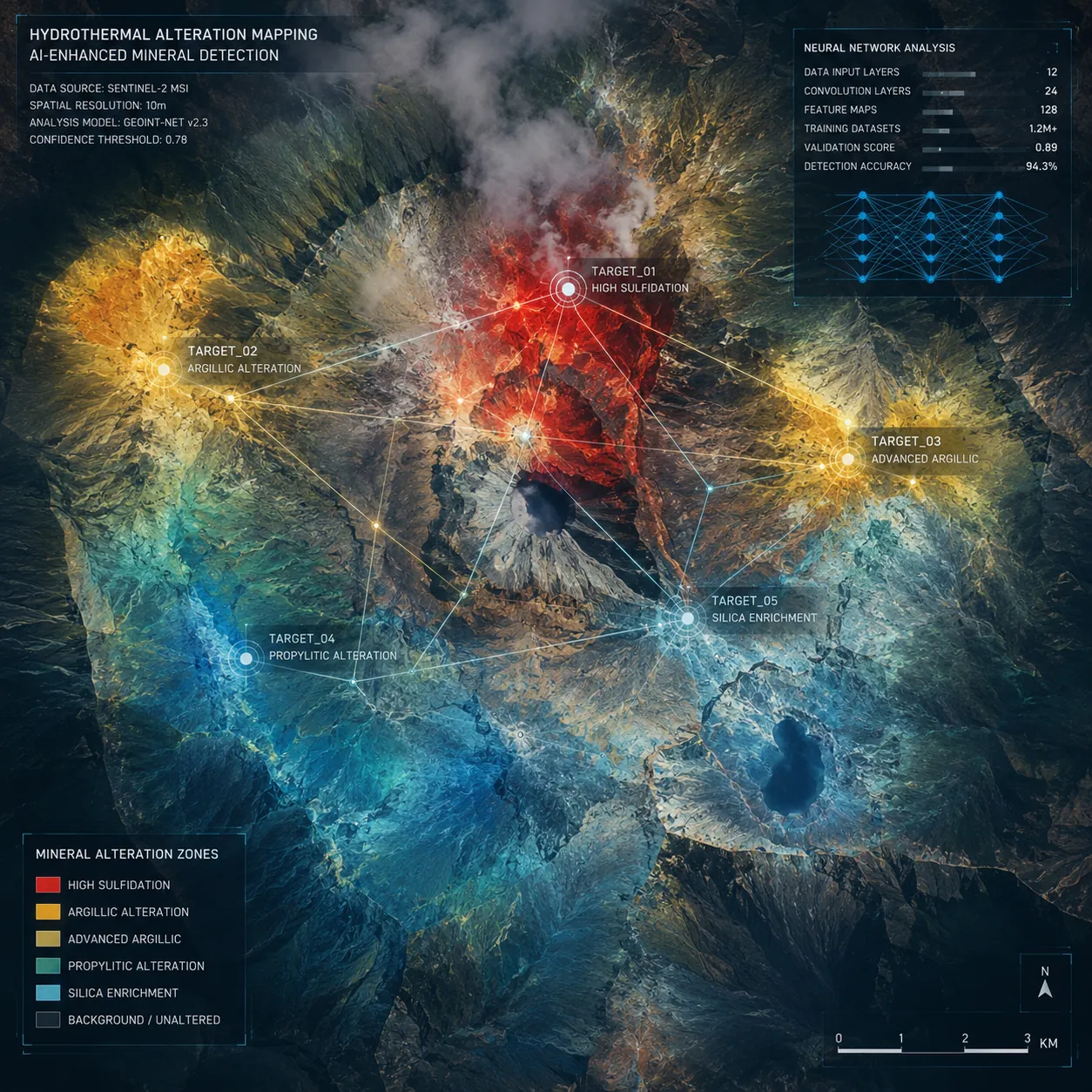
01 · Hydrothermal Zone Mapping
Hydrothermal Zone Mapping
What It Is
The platform detects rock altered by hot mineral-rich fluids underground — one of the strongest indicators of nearby ore systems.
What You Get
Priority-ranked exploration zones with high mineralization potential.
Result
Weeks of reconnaissance compressed into satellite analysis.
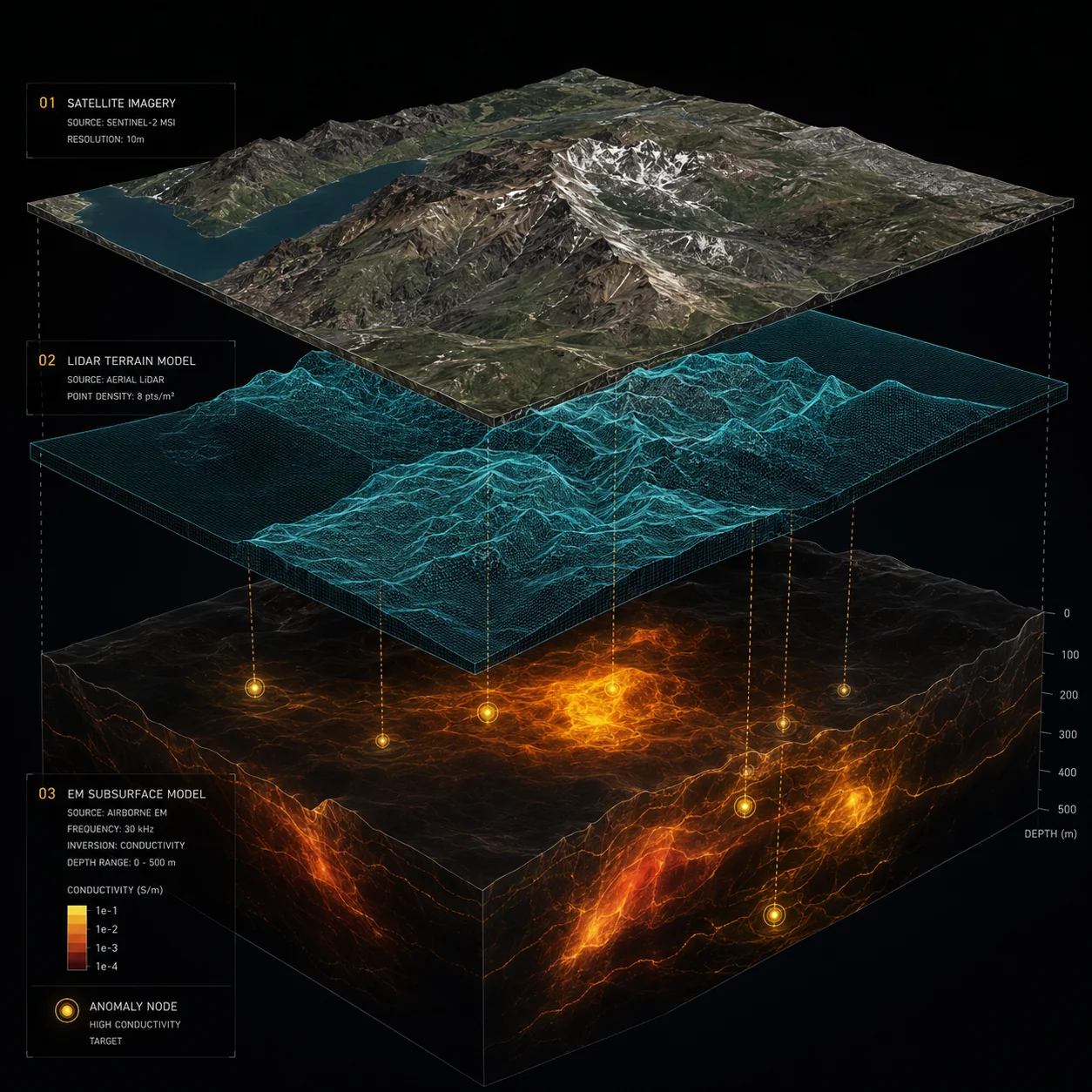
02 · LiDAR + AEM + CNN
Prospecting with LiDAR, Airborne Electromagnetic (AEM) and Convolutional Neural Network(CNNCNN — Convolutional Neural Network: An AI model that analyzes satellite band data to identify mineral signatures.)
What It Is
Convolutional Neural Network: An AI model trained on multispectral satellite bands to identify subsurface mineral signatures with high precision. The platform combines three exploration layers into a unified targeting system:
- CNNCNN — Convolutional Neural Network: An AI model that analyzes satellite band data to identify mineral signatures.-analyzed satellite imagery for mineral signatures
- LiDAR for terrain and structural mapping
- Airborne Electromagnetic (AEM) data for subsurface conductivity insights
What You Get
Ranked drill targets with confidence scoring.
Result
Better targeting. Less unnecessary drilling.
03 · Mineral Identification
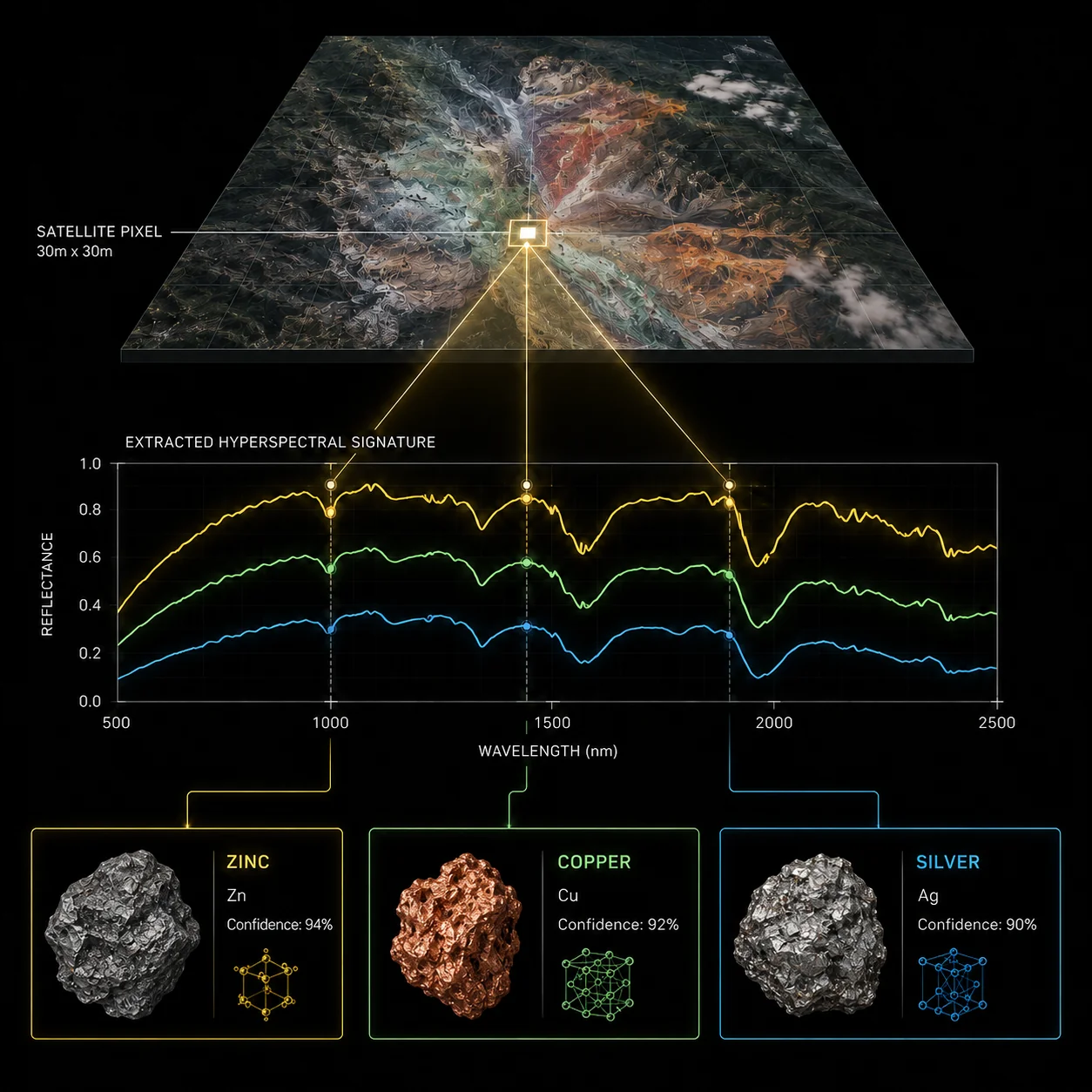
Mineral Identification from Satellite Pixels
What It Is
Each satellite pixel can contain mixed mineral signals. Our models separate and identify those signatures to estimate mineral composition across large areas.
What You Get
Mineral distribution intelligence before committing to expensive ground programs.
04 · Vegetation Stress
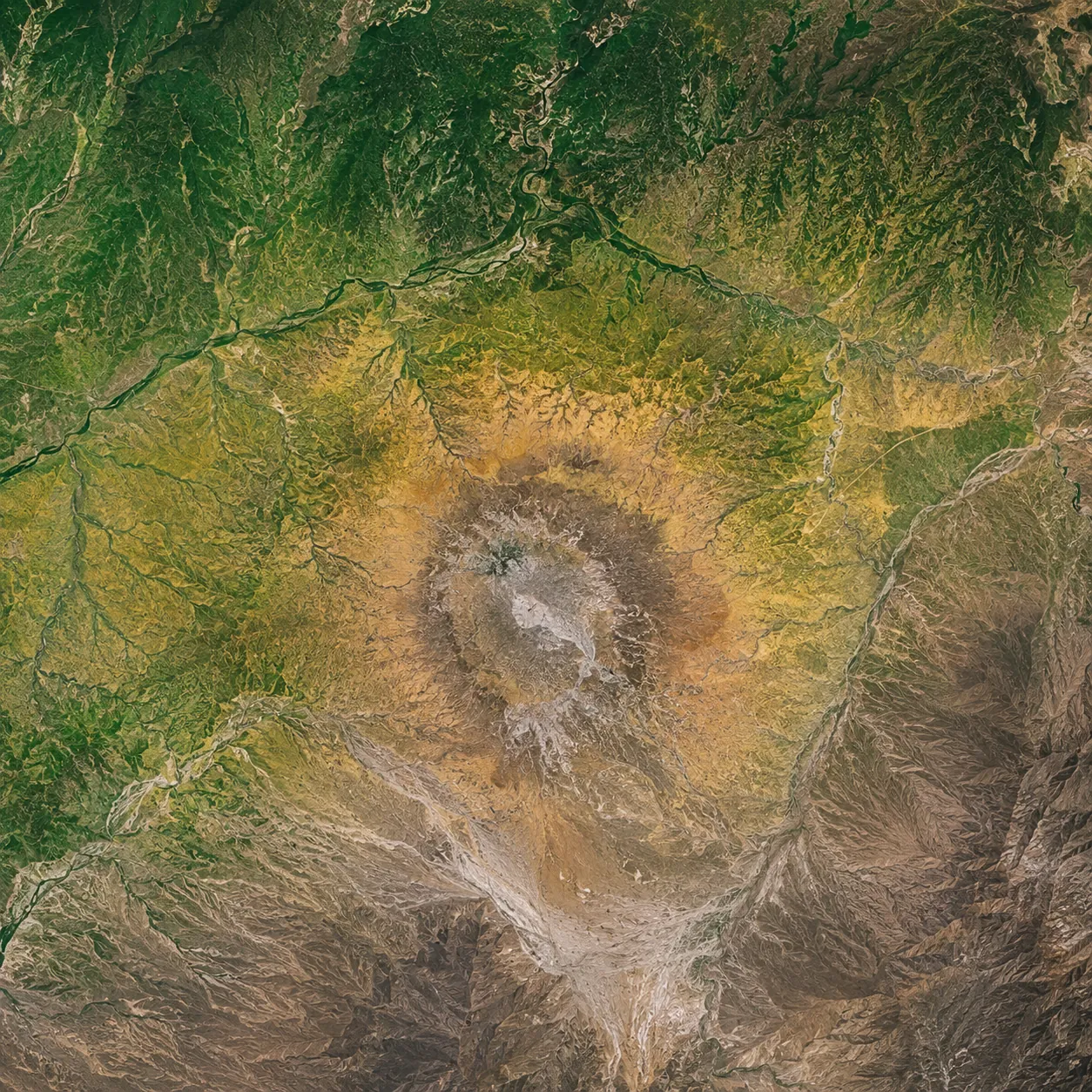
Vegetation Stress Detection
What It Is
Certain buried mineral systems create chemical stress in surface vegetation. That stress becomes visible in multispectral satellite imagery.
What You Get
Additional exploration signals that conventional programs often miss.
Why Hawkeyes
Built Specifically for Mining Exploration
What We Do
AI-Powered Geological ProcessingWhy It Matters
Analyze years of exploration data in daysWhat We Do
CNNCNN — Convolutional Neural Network: An AI model that analyzes satellite band data to identify mineral signatures.-Based Pattern RecognitionWhy It Matters
Detect geological structures invisible to manual reviewWhat We Do
Multi-Source Data IntegrationWhy It Matters
Combine satellite, LiDAR, AEM, and terrain intelligenceWhat We Do
Mining-Specific AI ModelsWhy It Matters
Trained for exploration geology – not generic imageryWhat We Do
Actionable OutputsWhy It Matters
Maps and targets your geological team can immediately useAbout Hawkeyes
Major mining companies have used satellite-assisted exploration internally for years
Most junior and mid-tier operators don't have access to those capabilities.
That creates an uneven playing field: large firms operate with deep exploration intelligence while smaller companies rely heavily on expensive field programs and incomplete data.
Hawkeyes was built to close that gap.
We focus exclusively on mining and mineral exploration. Nothing else.
Harvey Lawson
(CEO)
Harvey Lawson has worked across exploration, mining finance, investor relations, venture capital, and private placements.
Throughout his career, he saw the same recurring issue: smaller operators were making drilling decisions with limited geological intelligence while major firms relied on advanced satellite analysis systems kept entirely in-house. Hawkeyes was built to make those capabilities accessible.
Harvey holds an MBA in Finance from The Manchester Business School.
LinkedIn
Pricing
Every Quote Is Built Around Your Project
No fixed prices. Once we understand your property, we prepare a tailored quote — it starts with a short call.
What You Get
Satellite & Drone, Combined
High-resolution satellite data fused with close-range drone intelligence. Two independent data streams, one AI model, one precise answer — exactly where to drill.
- High-resolution satellite over all priority zones
- Drone survey at 30–100 m above ground
- Dual AI model fusing both data sources
- Drill-intercept targets with UTM coordinates
- Full delivery package, client-owned
Preview a Sample Report
Here's a look at the first two pages of a sample report.
Your Next Drill Will Be Our Satellite.
Send us your project coordinates and we'll show you exactly where to dig — for a lot less than the traditional way.
To see a sample report, please fill out this form accurately.
Note: All information is held in strict confidence.